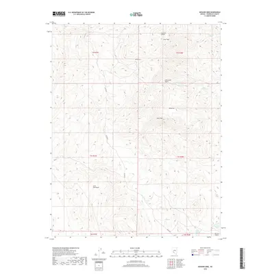
2018 Map of Mohawk Mine
USGS Topo · Published 2018About this map
Mohawk Mine sits high in the high-desert terrain of Esmeralda County, providing a focal point for the industrial history of the Silver Peak Range. This landscape is defined by its dramatic elevation changes and essential water sources, which dictated the viability of prospecting and ranching in the Great Basin. Access across the topography is primarily facilitated by McAfee Rd, which threads between significant peaks like Sheep Mtn and Silver Peak. The presence of numerous water features, including Company Spring, Big Spring, and the Upper Cowcamp Spring, suggests a network of crucial stopovers for both early miners and livestock. From the depths of Argentite Canyon to the broad expanse of Sheep Flat, the map reveals a territory where survival and industry were inextricably linked to the location of these isolated springs.
Find a feature on this map
21 named features on this map. Tap any name to fly to it.
Don’t see what you’re looking for? This feature index may not catch every label — zoom into the map to look around manually.
Map Details
Editions of this 2018 Mohawk Mine Map
This is the sole edition of this map. No revisions or reprints were ever made.
Other maps of this area

1898 · Silver Peak
USGS Topo · 1:125,000

1900 · Silver Peak
USGS Topo · 1:125,000

1908 · Lida
USGS Topo · 1:250,000

1913 · Lida
USGS Topo · 1:250,000

1954 · Goldfield
USGS Topo · 1:250,000

1955 · Goldfield
USGS Topo · 1:250,000

1958 · Goldfield
USGS Topo · 1:250,000

1962 · Goldfield
USGS Topo · 1:250,000
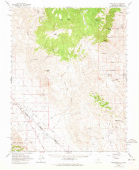
1963 · Piper Peak
USGS Topo · 1:62,500

1963 · Silver Peak
USGS Topo · 1:62,500