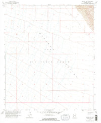
1965 Map of Mohawk SE
USGS Topo · Published 1966About this map
Luke Air Force Range dominates the terrain of this mid-1960s survey, illustrating the significant military footprint in the Arizona desert. The map captures the broad expanse of the Mohawk Valley, where the landscape is defined by vast, open basins and shifting Sand Dunes in the northeastern corner. This period of mapping reflects a time when the region was primarily utilized for military aviation training and aerial gunnery, with very little civilian infrastructure. Sparse corridors of unimproved dirt roads are the only signs of transit through this arid landscape, highlighting the isolation of the range during the Cold War era. The topography, documented through photogrammetric methods from 1962 aerial photography and earlier surveys by the U.S. Bureau of Reclamation, provides a precise record of the desert floor's elevation and natural drainage patterns.
Find a feature on this map
7 named features on this map. Tap any name to fly to it.
Don’t see what you’re looking for? This feature index may not catch every label — zoom into the map to look around manually.
Map Details
Editions of this 1965 Mohawk SE Map
2 editions found
Other maps of this area

1926 · Mohawk
USGS Topo · 1:62,500

1927 · Kim
USGS Topo · 1:62,500

1928 · Mohawk
USGS Topo · 1:62,500

1931 · Kim
USGS Topo · 1:62,500

1953 · Ajo
USGS Topo · 1:250,000

1957 · Ajo
USGS Topo · 1:250,000

1958 · Ajo
USGS Topo · 1:250,000

1962 · Ajo
USGS Topo · 1:250,000

1963 · Ajo
USGS Topo · 1:250,000

1965 · Cabeza Prieta Peak
USGS Topo · 1:62,500