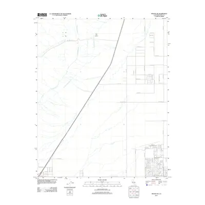
2012 Map of Mojave NE
USGS Topo · Published 2012About this map
The desert landscape of Kern County is defined by major infrastructure and the grid-based planning of California City in the early 2010s. This survey highlights the critical water corridors of the Los Angeles Aqueduct and the Second Los Angeles Aqueduct, which cut diagonally across the arid terrain near Pine Tree Canyon. The map reveals the ambitious but largely unbuilt street networks of the region, where long desert boulevards like Cheyenne Blvd and Washburn Blvd extend into the brush, far from the established hub of the California City Municipal Airport. Researchers can observe the contrast between the densely platted residential streets in the southeast, near Mendiburu Rd and Baron Blvd, and the open expanses to the north and west where only a few roads like Gantt Rd provide access.
Find a feature on this map
64 named features on this map. Tap any name to fly to it.
Don’t see what you’re looking for? This feature index may not catch every label — zoom into the map to look around manually.
Map Details
Editions of this 2012 Mojave NE Map
This is the sole edition of this map. No revisions or reprints were ever made.
Other maps of this area

1915 · Searles Lake
USGS Topo · 1:250,000

1915 · Mojave
USGS Topo · 1:125,000

1943 · Cross Mountain
USGS Topo · 1:62,500

1943 · Saltdale
USGS Topo · 1:62,500

1943 · Castle Butte
USGS Topo · 1:62,500

1943 · Mojave
USGS Topo · 1:62,500

1947 · Castle Butte
USGS Topo · 1:50,000

1947 · Plano
USGS Topo · 1:24,000

1947 · Mojave
USGS Topo · 1:24,000

1947 · Desert Butte
USGS Topo · 1:24,000