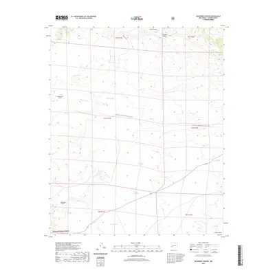
2020 Map of Mojonera Canyon
USGS Topo · Published 2020About this map
The Continental Divide winds through this high-elevation corner of Catron County, defining a landscape of deep canyons and seasonal water catchments within the Gila National Forest. The 2020 terrain is marked by a network of ranching-related water features, such as Henry Ford Tank, Dead Steer Tank, and Rock House Tank, which are critical infrastructure in this arid environment. The passage of the Continental Divide National Scenic Trail provides a modern recreational layer over the established topography of Mojonera Canyon and Alamo Canyon. This area reflects a long-standing land-use pattern where public forest management and remote cattle ranching intersect, evidenced by the scattered stock tanks and the winding path of Forest Rd 30 cutting across the northern reaches.
Find a feature on this map
24 named features on this map. Tap any name to fly to it.
Don’t see what you’re looking for? This feature index may not catch every label — zoom into the map to look around manually.
Map Details
Editions of this 2020 Mojonera Canyon Map
This is the sole edition of this map. No revisions or reprints were ever made.
Other maps of this area

1918 · Pelona
USGS Topo · 1:125,000

1954 · Tularosa
USGS Topo · 1:250,000

1954 · Clifton
USGS Topo · 1:250,000

1957 · Clifton
USGS Topo · 1:250,000

1958 · Clifton
USGS Topo · 1:250,000

1958 · Tularosa
USGS Topo · 1:250,000

1962 · Clifton
USGS Topo · 1:250,000

1965 · Wahoo Peak
USGS Topo · 1:24,000

1979 · San Mateo Mountains
USGS Topo · 1:100,000
1981 · Pelona Mountain
USGS Topo · 1:24,000