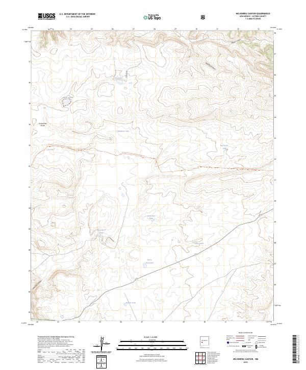
2023 Map of Mojonera Canyon
USGS Topo · Published 2023About this map
The Continental Divide National Scenic Trl winds through this high-altitude landscape in the Gila National Forest, crossing a terrain defined by deep drainages and scattered water catchments. The Continental Divide itself serves as the primary geographic spine of the area, separating the headwaters of Mojonera Canyon and Alamo Canyon to the north from Railroad Canyon in the southwest. This region is characterized by a network of essential water tanks and small lakes, such as Laguna Hondo and the aptly named Dead Steer Tank, reflecting the area's history of managing livestock and natural resources in an arid environment. Access remains focused on the central corridor provided by Forest Rd 30, while specialized local landmarks like Rock House Tank and Henry Ford Tank provide specific points of reference for those tracing ranching heritage or land-use patterns within these forest boundaries.
Find a feature on this map
23 named features on this map. Tap any name to fly to it.
Don’t see what you’re looking for? This feature index may not catch every label — zoom into the map to look around manually.
Map Details
Editions of this 2023 Mojonera Canyon Map
This is the sole edition of this map. No revisions or reprints were ever made.
Other maps of this area

1918 · Pelona
USGS Topo · 1:125,000

1954 · Tularosa
USGS Topo · 1:250,000

1954 · Clifton
USGS Topo · 1:250,000

1957 · Clifton
USGS Topo · 1:250,000

1958 · Clifton
USGS Topo · 1:250,000

1958 · Tularosa
USGS Topo · 1:250,000

1962 · Clifton
USGS Topo · 1:250,000

1965 · Wahoo Peak
USGS Topo · 1:24,000

1979 · San Mateo Mountains
USGS Topo · 1:100,000
1981 · Pelona Mountain
USGS Topo · 1:24,000