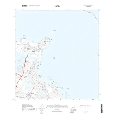
2017 Map of Mokapu Point
USGS Topo · Published 2017About this map
The Mokapu Peninsula and the coastal community of Kailua anchor this 2017 survey of O‘ahu's windward coast. The peninsula is dominated by the Kaneohe Bay Marine Corps Air Station, a major military installation situated between Kāne‘ohe Bay and the open ocean. Notable geological formations include Ulupa‘u Crater and the distinctive Pyramid Rock at the northern tip.
Find a feature on this map
133 named features on this map. Tap any name to fly to it.
Don’t see what you’re looking for? This feature index may not catch every label — zoom into the map to look around manually.
Map Details
Editions of this 2017 Mokapu Point Map
This is the sole edition of this map. No revisions or reprints were ever made.
Other maps of this area

1952 · Koko Head
USGS Topo · 1:24,000

1952 · Mokapu
USGS Topo · 1:24,000

1953 · Honolulu
USGS Topo · 1:24,000

1954 · Oahu
USGS Topo · 1:250,000

1954 · Kahana
USGS Topo · 1:24,000

1954 · Kaneohe
USGS Topo · 1:24,000

1959 · Mokapu
USGS Topo · 1:24,000

1959 · Koko Head
USGS Topo · 1:24,000

1959 · Kaneohe
USGS Topo · 1:24,000

1959 · Honolulu
USGS Topo · 1:24,000