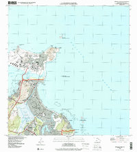
1998 Map of Mokapu Point
USGS Topo · Published 2000About this map
The Mokapu Peninsula and the windward coast of Oahu are defined here by a dense mix of military installations and residential communities. Dominating the northern landmass is the Marine Corps Base Hawaii - Kaneohe Bay, featuring the Klipper Golf Course and geological landmarks like Ulupa'u Crater and Pyramid Rock. To the south, the sprawling residential street grids of Kailua and Lanikai are framed by significant wetlands and water bodies, including Kawainui Marsh and the Kawainui Nature Reserve. This late-twentieth-century landscape highlights the careful balance between development and preservation, as seen in the numerous protected areas like the Mokumanu State Seabird Sanctuary and the Ulukoi Heiau State Monument. Cultural and educational centers are well-represented by institutions such as St Anthony Sch and Kailua High Sch, while the coastline is marked by distinct points such as Alāla Point and Kapoho Point.
Find a feature on this map
48 named features on this map. Tap any name to fly to it.
Don’t see what you’re looking for? This feature index may not catch every label — zoom into the map to look around manually.
Map Details
Editions of this 1998 Mokapu Point Map
This is the sole edition of this map. No revisions or reprints were ever made.
Other maps of this area

1952 · Koko Head
USGS Topo · 1:24,000

1952 · Mokapu
USGS Topo · 1:24,000

1953 · Honolulu
USGS Topo · 1:24,000

1954 · Oahu
USGS Topo · 1:250,000

1954 · Kahana
USGS Topo · 1:24,000

1954 · Kaneohe
USGS Topo · 1:24,000

1959 · Mokapu
USGS Topo · 1:24,000

1959 · Koko Head
USGS Topo · 1:24,000

1959 · Kaneohe
USGS Topo · 1:24,000

1959 · Honolulu
USGS Topo · 1:24,000