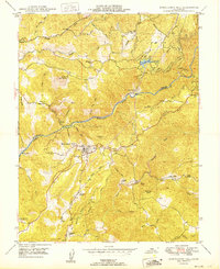
1949 Map of Mokelumne Hill
USGS Topo · Published 1949About this map
The Mokelumne River carves a deep boundary between Amador and Calaveras counties, anchoring a landscape shaped by early California industry and settlement. Mokelumne Hill serves as the primary hub, surrounded by smaller communities and family holdings like McSorley Ranch and Lombardi Ranch. Evidence of the Gold Country's past is visible in the (Butte City) Ruins and mining operations such as the Le Roi Mine and Blue Jay Mine. The infrastructure of the late 1940s is well-defined, showing the Amador Canal leading to Lake Tabeaud and the Powerhouse at Electra. This network of canals, siphons, and flumes, alongside the Pardee Res in the west, illustrates the critical role of water management in the region's development. Rural education is marked by the Milligan Sch, while the Ponderosa Way winds through the hills, providing a glimpse into the mid-century transportation and fire-access routes of the Mother Lode.
Find a feature on this map
48 named features on this map. Tap any name to fly to it.
Don’t see what you’re looking for? This feature index may not catch every label — zoom into the map to look around manually.
Map Details
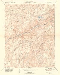
Editions of this 1949 Mokelumne Hill Map
2 editions found
Other maps of this area

1889 · Jackson
USGS Topo · 1:125,000

1892 · Jackson
USGS Topo · 1:125,000

1897 · Jackson
USGS Topo · 1:125,000

1902 · Jackson
USGS Topo · 1:125,000

1941 · Sutter Creek
USGS Topo · 1:62,500

1944 · Valley Springs
USGS Topo · 1:62,500

1944 · Sutter Creek
USGS Topo · 1:62,500

1945 · San Andreas
USGS Topo · 1:62,500

1947 · San Andreas
USGS Topo · 1:62,500

1947 · Sacramento
USGS Topo · 1:250,000