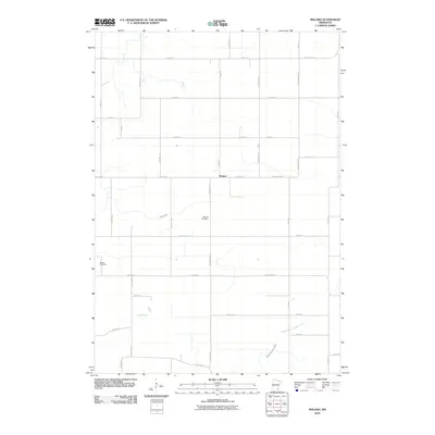
2010 Map of Moland
USGS Topo · Published 2010About this map
Moland sits at the heart of this agricultural landscape in southeastern Minnesota, serving as a focal point for the surrounding rural community. The settlement is anchored by the Moland Cemetery, while further west, the Merton Cemetery serves as another vital record of local family history and genealogy. The terrain is defined by its drainage patterns, most notably the Middle Fork Zumbro River cutting through the southeastern corner and Rush Creek winding through the central sections. A systematic grid of section roads, including County HWY-10 and County HWY-24, connects the dispersed farmsteads, reflecting the enduring township-and-range surveying system that has organized this prairie-and-river landscape since the nineteenth century.
Find a feature on this map
43 named features on this map. Tap any name to fly to it.
Don’t see what you’re looking for? This feature index may not catch every label — zoom into the map to look around manually.
Map Details
Editions of this 2010 Moland Map
This is the sole edition of this map. No revisions or reprints were ever made.
Other maps of this area

1953 · Saint Paul
USGS Topo · 1:250,000

1959 · Saint Paul
USGS Topo · 1:250,000

1960 · Cannon City
USGS Topo · 1:24,000

1960 · Nerstrand
USGS Topo · 1:24,000

1962 · Medford East
USGS Topo · 1:24,000

1962 · Owatonna
USGS Topo · 1:24,000

1962 · Moland
USGS Topo · 1:24,000

1962 · Owatonna SE
USGS Topo · 1:24,000

1965 · Claremont
USGS Topo · 1:24,000

1965 · West Concord
USGS Topo · 1:24,000