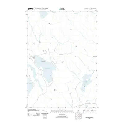
2011 Map of Molasses Pond
USGS Topo · Published 2011About this map
Molasses Pond and the surrounding Hancock County wetlands dominate this landscape, reflecting a region defined by its complex glacial hydrology and remote character. The map identifies several smaller water bodies such as Scammon Pond, Abrams Pond, and Narraguagus Lake, which are interconnected by a network of drainage ways including Bog River and Macomber Mill Stream. Notable for family historians, the Crimmins Cemetery sits near the western shore of the pond, adjacent to Crimmins Island. The local road system, including Molasses Pond Rd and Sugar Hill Rd, connects scattered points of interest like the Molasses Pond Boat Launch and the small settlement at Chez Vent. This map details a terrain of low ridges and knolls, such as Myrick Ridge and Beech Knoll, which separate the various brook and river basins that feed into the larger pond systems.
Find a feature on this map
55 named features on this map. Tap any name to fly to it.
Don’t see what you’re looking for? This feature index may not catch every label — zoom into the map to look around manually.
Map Details
Editions of this 2011 Molasses Pond Map
This is the sole edition of this map. No revisions or reprints were ever made.
Other maps of this area

1911 · Ellsworth
USGS Topo · 1:62,500

1929 · Great Pond
USGS Topo · 1:48,000

1929 · Lead Mountain
USGS Topo · 1:48,000

1930 · Tunk Lake
USGS Topo · 1:48,000

1932 · Tunk Lake
USGS Topo · 1:62,500

1932 · Lead Mountain
USGS Topo · 1:62,500

1932 · Great Pond
USGS Topo · 1:62,500

1940 · Ellsworth
USGS Topo · 1:62,500

1942 · Ellsworth
USGS Topo · 1:62,500

1942 · Tunk Lake
USGS Topo · 1:62,500