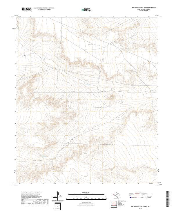
2022 Map of Molesworth Mesa South
USGS Topo · Published 2022About this map
Molesworth Mesa dominates the northern reaches of this Hudspeth County landscape, providing a high vantage point over a series of ephemeral drainage systems and water collection points. In this arid region, the management of water is clearly defined by features like the Antelope Tanks, Hobo Tank, and Drag Tank, which dot the terrain to support ranching or local wildlife. The geography is carved by seasonal watercourses, including Number Nine Draw and the more extensive Antelope Draw that winds through the southern portion of the quadrangle. Human infrastructure is primarily represented by the straight path of Pipeline Rd, which cuts horizontally across the central mesa, reflecting the industrial and logistical utility of this high desert environment in the early 21st century.
Find a feature on this map
7 named features on this map. Tap any name to fly to it.
Don’t see what you’re looking for? This feature index may not catch every label — zoom into the map to look around manually.
Map Details
Editions of this 2022 Molesworth Mesa South Map
This is the sole edition of this map. No revisions or reprints were ever made.
Other maps of this area

1903 · Cerro Alto
USGS Topo · 1:125,000

1943 · Tepee Butte
USGS Topo · 1:62,500

1943 · San Antonio Mtn
USGS Topo · 1:62,500

1951 · Red Hills
USGS Topo · 1:62,500

1954 · Van Horn
USGS Topo · 1:250,000

1955 · Cerro Diablo
USGS Topo · 1:62,500

1958 · Van Horn
USGS Topo · 1:250,000
1978 · Granite Mountain
USGS Topo · 1:24,000
1978 · Molesworth Mesa South
USGS Topo · 1:24,000
1978 · Tepee Butte SW
USGS Topo · 1:24,000