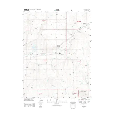
2013 Map of Molina
USGS Topo · Published 2013About this map
The Plateau Valley serves as a vital corridor in this part of Mesa County, where the settlement of Molina is situated along the banks of Plateau Creek. The landscape is defined by a series of named homesteads and local institutions that speak to the area's ranching and agricultural heritage, including the Tanner Homestead, Miller Homestead, and the McKenny Homestead. Educational history is particularly well-represented on this map, which identifies the Bull Creek School, Georgia Mesa School, Eagalite School, and Mormon Mesa School. To the south, the terrain rises toward the Grand Mesa National Forest, with water managed through systems like the S Side Canal and the Mormon Mesa Ditch. Notable landmarks such as The Beehive and Round Mountain punctuate the mesas, while the Mesa Cem provides a focal point for genealogical interest.
Find a feature on this map
69 named features on this map. Tap any name to fly to it.
Don’t see what you’re looking for? This feature index may not catch every label — zoom into the map to look around manually.
Map Details
Editions of this 2013 Molina Map
This is the sole edition of this map. No revisions or reprints were ever made.
Other maps of this area

1929 · Grand Valley
USGS Topo · 1:62,500

1955 · Collbran
USGS Topo · 1:24,000

1955 · Mesa
USGS Topo · 1:24,000

1955 · Grand Mesa
USGS Topo · 1:24,000

1955 · Molina
USGS Topo · 1:24,000

1955 · Skyway
USGS Topo · 1:24,000

1956 · Grand Junction
USGS Topo · 1:250,000

1957 · Leadville
USGS Topo · 1:250,000

1959 · Grand Junction
USGS Topo · 1:250,000

1959 · Leadville
USGS Topo · 1:250,000