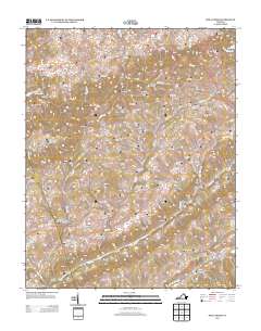
2013 Map of Moll Creek
USGS Topo · Published 2013About this map
Copper Creek and Big Moccasin Creek define the complex drainage patterns of this Southwest Virginia landscape, where small hamlets like Mew and Banners Corner sit along the winding valley roads. The terrain is marked by a sequence of distinctive ridges and hollows, such as Bakers Ridge and Osborne Hollow, which have historically shaped the local settlement and road network. Evidence of early rural communities is found at Point Truth and Tumbez, positioned along the watercourses that once powered local life. The map reveals how the steep topography of Duff Knob and Porter Hollow dictates the placement of secondary routes like Copper Ridge Road, illustrating the enduring relationship between the geology of Russell County and its inhabitant's navigation of the land.
Find a feature on this map
78 named features on this map. Tap any name to fly to it.
Don’t see what you’re looking for? This feature index may not catch every label — zoom into the map to look around manually.
Map Details
Editions of this 2013 Moll Creek Map
This is the sole edition of this map. No revisions or reprints were ever made.
Other maps of this area

1897 · Bristol
USGS Topo · 1:125,000

1902 · Bristol
USGS Topo · 1:125,000

1918 · Carterton
USGS Topo · 1:62,500

1920 · Coeburn
USGS Topo · 1:48,000

1934 · Wallace
USGS Topo · 1:24,000

1934 · Hansonville
USGS Topo · 1:24,000
1934 · Carbo
USGS Topo · 1:24,000

1935 · Hilton
USGS Topo · 1:24,000

1935 · Mendota
USGS Topo · 1:24,000
1935 · Moll Creek
USGS Topo · 1:24,000