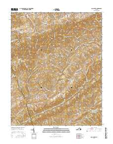
2016 Map of Moll Creek
USGS Topo · Published 2016About this map
Castlewood and Banners Corner sit along the northern edge of this Russell County landscape, where the historic Trl Of The Lonesome Pine winds through the limestone hills. The terrain is defined by a dense network of family-named hollows and ridges, including Osborne Hollow and Copper Ridge, which have shaped local settlement patterns for generations. A notable density of family burial grounds is scattered across the topography, with Artrip Cem, Gose Cem, and Quillen Cem providing critical data points for genealogists tracking the area's early residents.
Find a feature on this map
132 named features on this map. Tap any name to fly to it.
Don’t see what you’re looking for? This feature index may not catch every label — zoom into the map to look around manually.
Map Details
Editions of this 2016 Moll Creek Map
This is the sole edition of this map. No revisions or reprints were ever made.
Other maps of this area

1897 · Bristol
USGS Topo · 1:125,000

1902 · Bristol
USGS Topo · 1:125,000

1918 · Carterton
USGS Topo · 1:62,500

1920 · Coeburn
USGS Topo · 1:48,000

1934 · Wallace
USGS Topo · 1:24,000

1934 · Hansonville
USGS Topo · 1:24,000
1934 · Carbo
USGS Topo · 1:24,000

1935 · Hilton
USGS Topo · 1:24,000

1935 · Mendota
USGS Topo · 1:24,000
1935 · Moll Creek
USGS Topo · 1:24,000