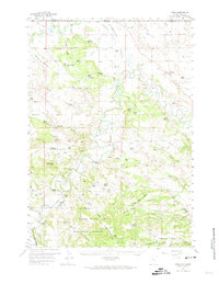
1957 Map of Mona
USGS Topo · Published 1974About this map
Ranching and rugged terrain define this 1957 snapshot of the Wyoming-Montana borderlands, where the Belle Fourche River and Missouri River carve through the landscape. The northern edge of the Black Hills National Forest dominates the southern half of the map, rising into the Bear Lodge Mountains. This is a remote livestock economy in the mid-20th century, evidenced by the high density of family-held properties such as the Ridinger Ranch, Stoboda Ranch, and Cross Anchor Ranch.
Find a feature on this map
71 named features on this map. Tap any name to fly to it.
Don’t see what you’re looking for? This feature index may not catch every label — zoom into the map to look around manually.
Map Details
Editions of this 1957 Mona Map
2 editions found
Other maps of this area

1901 · Aladdin
USGS Topo · 1:125,000

1903 · Aladdin
USGS Topo · 1:125,000

1905 · Devils Tower
USGS Topo · 1:125,000

1954 · Ekalaka
USGS Topo · 1:250,000

1954 · Gillette
USGS Topo · 1:250,000

1955 · Devils Tower
USGS Topo · 1:62,500

1955 · Gillette
USGS Topo · 1:250,000

1956 · Ekalaka
USGS Topo · 1:250,000

1957 · Mona
USGS Topo · 1:62,500

1957 · Seely
USGS Topo · 1:62,500