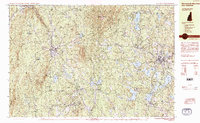
1984 Map of Monadnock Mountain
USGS Topo · Published 1984About this map
Monadnock State Park serves as the focal point of this Cheshire County landscape, where the prominent peak of Monadnock Mountain rises above a network of smaller heights like Gap Mtn and Cubleigh Hill. This 1984 survey reveals the established infrastructure of the southwestern New Hampshire highlands, centered on the industrial and residential hubs of Troy, Jaffrey, and Fitzwilliam. The Boston and Maine RR cuts a winding path through the terrain, passing through Fitzwilliam Depot and linking the smaller settlements.
Find a feature on this map
71 named features on this map. Tap any name to fly to it.
Don’t see what you’re looking for? This feature index may not catch every label — zoom into the map to look around manually.
Map Details
Editions of this 1984 Monadnock Mountain Map
2 editions found
Other maps of this area

1887 · Warwick
USGS Topo · 1:62,500

1887 · Winchendon
USGS Topo · 1:62,500

1887 · Fitchburg
USGS Topo · 1:62,500

1889 · Fitchburg
USGS Topo · 1:62,500

1889 · Warwick
USGS Topo · 1:62,500

1890 · Winchendon
USGS Topo · 1:62,500

1893 · Fitchburg
USGS Topo · 1:62,500

1894 · Winchendon
USGS Topo · 1:62,500

1894 · Warwick
USGS Topo · 1:62,500

1898 · Monadnock
USGS Topo · 1:62,500