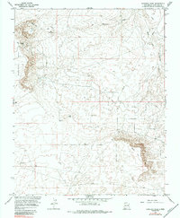
1966 Map of Moncisco Wash
USGS Topo · Published 1984About this map
Bisti Oil Field dominates this high-desert landscape in San Juan County, revealing the industrial footprint of petroleum exploration during the mid-1960s. The terrain is characterized by broad erosional features like Moncisco Mesa and the drainage of Moncisco Wash, which cuts across the northern reaches of the sheet. Surveyed by the U.S. Bureau of Reclamation and the Geological Survey, the map documents a network of extraction infrastructure including numerous Oil Wells, a solitary Radio Tower, and an extensive Pipeline system. In the southern half of the quadrangle, the elevation drops at Black Hill, while isolated water sources like Jeters Lake provide rare landmarks in an otherwise arid expanse. This survey captures the region just as energy development was intensifying, providing a clear record of the specific drill sites and access tracks that defined the local economy.
Find a feature on this map
11 named features on this map. Tap any name to fly to it.
Don’t see what you’re looking for? This feature index may not catch every label — zoom into the map to look around manually.
Map Details
Editions of this 1966 Moncisco Wash Map
2 editions found
Other maps of this area

1889 · Chaco
USGS Topo · 1:250,000

1892 · Chaco
USGS Topo · 1:250,000

1927 · Sulphur Spring
USGS Topo · 1:96,000

1928 · Kirtland
USGS Topo · 1:125,000

1932 · Kirtland
USGS Topo · 1:125,000

1954 · Shiprock
USGS Topo · 1:250,000

1958 · Shiprock
USGS Topo · 1:250,000

1959 · Shiprock
USGS Topo · 1:250,000
1965 · Gallegos Trading Post
USGS Topo · 1:24,000
1965 · Hugh Lake
USGS Topo · 1:24,000