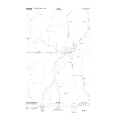
2013 Map of Mondovi
USGS Topo · Published 2013About this map
Mondovi serves as the central hub of this Wisconsin landscape, where the Buffalo River winds through a complex topography of named valleys. The town's infrastructure is highlighted by the Mondovi Water Works and the proximity of Mirror Lake, while the surrounding rural landscape is defined by established agricultural holdings such as Castleholm Farm, Heike Farms, and Olson Farms. This 2013 survey illustrates the persistence of family-named agricultural tracts and topographic landmarks in Buffalo County.
Find a feature on this map
73 named features on this map. Tap any name to fly to it.
Don’t see what you’re looking for? This feature index may not catch every label — zoom into the map to look around manually.
Map Details
Editions of this 2013 Mondovi Map
This is the sole edition of this map. No revisions or reprints were ever made.
Other maps of this area

1929 · Durand
USGS Topo · 1:62,500

1932 · Gilmanton
USGS Topo · 1:62,500

1932 · Durand
USGS Topo · 1:62,500

1932 · Alma
USGS Topo · 1:62,500

1932 · Mondovi
USGS Topo · 1:62,500

1950 · Alma
USGS Topo · 1:62,500

1953 · Eau Claire
USGS Topo · 1:250,000

1958 · Eau Claire
USGS Topo · 1:250,000

1964 · Eau Claire
USGS Topo · 1:250,000
1972 · Meridean
USGS Topo · 1:24,000