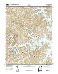
2013 Map of Moneta SW
USGS Topo · Published 2013About this map
Smith Mountain Lake dominates this 2013 survey of Franklin County, showing the intricate shoreline and residential development that emerged around the reservoir. The map documents numerous lakeside communities and developments including North Shore, Westlake Corner, and The Waterfront, highlighting the area's evolution into a major recreational and residential hub. The intricate network of local roads such as Lovely Valley Rd and Crafts Ford Rd provides access to private coves and peninsulas, reflecting the modern layout of the region.
Find a feature on this map
206 named features on this map. Tap any name to fly to it.
Don’t see what you’re looking for? This feature index may not catch every label — zoom into the map to look around manually.
Map Details
Editions of this 2013 Moneta SW Map
This is the sole edition of this map. No revisions or reprints were ever made.
Other maps of this area

1890 · Roanoke
USGS Topo · 1:125,000

1891 · Roanoke
USGS Topo · 1:125,000

1922 · Callands
USGS Topo · 1:48,000

1924 · Callands
USGS Topo · 1:62,500

1925 · Rocky Mount
USGS Topo · 1:48,000

1927 · Rocky Mount
USGS Topo · 1:62,500

1944 · Rocky Mount
USGS Topo · 1:62,500

1944 · Callands
USGS Topo · 1:62,500

1947 · Roanoke
USGS Topo · 1:250,000

1951 · Boones Mill
USGS Topo · 1:62,500