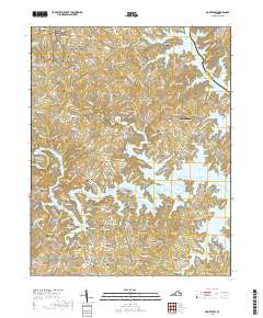
2019 Map of Moneta SW
USGS Topo · Published 2019About this map
Booker T Washington National Monument anchors the northwestern corner of this landscape where the Piedmont meets the vast waters of Smith Mountain Lake. This 2019 survey documents a region defined by its complex shoreline, where dozens of fingers and coves create a residential and recreational network around North Shore, Union Hall, and Westlake Corner. For family historians and genealogists, the map is remarkably dense with family-named burial sites, including the Poindexter-Saunders Cem, Holland-Mitchell Cem, and the Board-Robertson Cem. The terrain is deeply dissected by drainages like Gills Cr and Bettys Cr, illustrating how modern development follows the ridgelines above the flooded valleys of the Roanoke River basin. Older church locations such as Old Bethel Cem and many private family cemeteries remain as physical landmarks amid the expanding communities of Scruggs and Crossroads.
Find a feature on this map
205 named features on this map. Tap any name to fly to it.
Don’t see what you’re looking for? This feature index may not catch every label — zoom into the map to look around manually.
Map Details
Editions of this 2019 Moneta SW Map
This is the sole edition of this map. No revisions or reprints were ever made.
Other maps of this area

1890 · Roanoke
USGS Topo · 1:125,000

1891 · Roanoke
USGS Topo · 1:125,000

1922 · Callands
USGS Topo · 1:48,000

1924 · Callands
USGS Topo · 1:62,500

1925 · Rocky Mount
USGS Topo · 1:48,000

1927 · Rocky Mount
USGS Topo · 1:62,500

1944 · Rocky Mount
USGS Topo · 1:62,500

1944 · Callands
USGS Topo · 1:62,500

1947 · Roanoke
USGS Topo · 1:250,000

1951 · Boones Mill
USGS Topo · 1:62,500