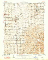
1943 Map of Monett
USGS Topo · Published 1950About this map
The St Louis San Francisco RR serves as the primary artery for these Missouri communities, connecting the rail hub at Monett with Pierce City, Verona, and Purdy. The landscape is a dense network of early mid-century rural institutions, particularly notable for its many country schools such as Lone Hill Sch and Pleasant Ridge Sch. The presence of the Waldensian Ch near Monett reflects the specific ethnic and religious heritage of the settlers who established vineyards and farms in this region.
Find a feature on this map
121 named features on this map. Tap any name to fly to it.
Don’t see what you’re looking for? This feature index may not catch every label — zoom into the map to look around manually.
Map Details
Editions of this 1943 Monett Map
3 editions found

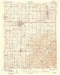
Other maps of this area

1886 · Greenfield
USGS Topo · 1:125,000

1886 · Carthage
USGS Topo · 1:125,000

1888 · Greenfield
USGS Topo · 1:125,000

1894 · Carthage
USGS Topo · 1:125,000

1919 · Halltown
USGS Topo · 1:62,500

1921 · Stotts City
USGS Topo · 1:62,500

1921 · Sarcoxie
USGS Topo · 1:62,500

1927 · Shell Knob
USGS Topo · 1:62,500

1937 · Cassville
USGS Topo · 1:48,000

1941 · Rocky Comfort
USGS Topo · 1:62,500