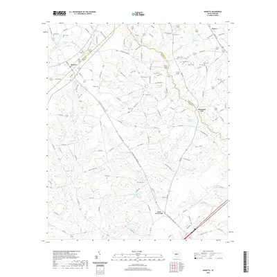
2020 Map of Monetta
USGS Topo · Published 2020About this map
Monetta and Jones Crossroads anchor this South Carolina landscape where the borders of Aiken, Saluda, and Lexington counties converge. The terrain is defined by a dense network of local routes, including Old Ninety Six Indian Trl and Old Two Notch Rd, which suggest the deep historical footprints of travel through this region. Family history is well-preserved across the map through numerous small burial sites such as Bethel Cem, Quattlebaum Cem, and Hartley Cem. Water systems like Chinquapin Cr and McTier Cr feed local landmarks like Kneeces Mill Pond and Du Base Pond, illustrating how the drainage patterns shaped the placement of farms and early homesteads. The presence of House Movers Field and various named ponds like Burtons Pond and Sawyer Pond reflect a landscape of rural utility and established community life.
Find a feature on this map
126 named features on this map. Tap any name to fly to it.
Don’t see what you’re looking for? This feature index may not catch every label — zoom into the map to look around manually.
Map Details
Editions of this 2020 Monetta Map
This is the sole edition of this map. No revisions or reprints were ever made.
Other maps of this area

1920 · Aiken
USGS Topo · 1:48,000

1921 · Aiken
USGS Topo · 1:62,500

1943 · Aiken
USGS Topo · 1:62,500

1944 · Gilbert
USGS Topo · 1:62,500

1944 · Seivern
USGS Topo · 1:62,500

1954 · Augusta
USGS Topo · 1:250,000

1957 · Augusta
USGS Topo · 1:250,000

1958 · Augusta
USGS Topo · 1:250,000

1961 · Augusta
USGS Topo · 1:250,000

1962 · Augusta
USGS Topo · 1:250,000