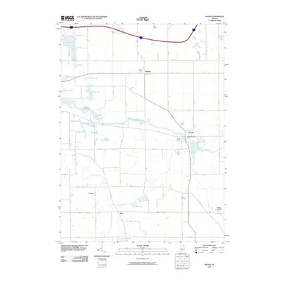
2010 Map of Mongo
USGS Topo · Published 2010About this map
Pigeon River and its associated wetlands define the landscape of eastern LaGrange County, weaving through a series of significant impoundments including Nasby Millpond and Mongo Millpond. The settlement of Mongo serves as a central hub, situated near the Mongo Reservoir Dam and surrounded by a cluster of local history markers like the K of P Cemetery and Mongo Cemetery. This area of Indiana is characterized by a complex hydrographic network, where Turkey Creek and East Fly Creek feed into broader marshes such as Massasauga Marsh and Pike Marsh.
Find a feature on this map
45 named features on this map. Tap any name to fly to it.
Don’t see what you’re looking for? This feature index may not catch every label — zoom into the map to look around manually.
Map Details
Editions of this 2010 Mongo Map
This is the sole edition of this map. No revisions or reprints were ever made.
Other maps of this area

1940 · Orland
USGS Topo · 1:24,000

1941 · Orland
USGS Topo · 1:24,000

1942 · Stroh
USGS Topo · 1:24,000

1947 · Mongo
USGS Topo · 1:24,000

1947 · Lagrange
USGS Topo · 1:24,000

1947 · Wolcottville
USGS Topo · 1:24,000

1947 · Oliver Lake
USGS Topo · 1:24,000

1953 · Fort Wayne
USGS Topo · 1:250,000

1956 · Fort Wayne
USGS Topo · 1:250,000

1959 · Wolcottville
USGS Topo · 1:24,000