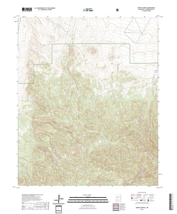
2023 Map of Monica Saddle
USGS Topo · Published 2023About this map
Cibola National Forest encompasses the high country of Socorro County, where water sources like Monica Spring and Ranch Supply Spring provide critical relief in an arid landscape. The area is defined by a complex network of drainages including Bolander Canyon, Durfee Canyon, and the deep cut of Monica Canyon. This modern topographic survey highlights the intersection of forest service access and historical routes, notably where Forest Rd 220 and Forest Rd 473 navigate the elevations toward Monica Saddle. The distribution of water features, such as Morley Tank and Aggie Spring, reflects the ongoing importance of range improvements and natural seeps in managing this remote territory. Traces of older transit are visible along the alignment of Old State Hwy 52, which skirts the eastern canyons near Switch Spring.
Find a feature on this map
32 named features on this map. Tap any name to fly to it.
Don’t see what you’re looking for? This feature index may not catch every label — zoom into the map to look around manually.
Map Details
Editions of this 2023 Monica Saddle Map
This is the sole edition of this map. No revisions or reprints were ever made.
Other maps of this area

1954 · Tularosa
USGS Topo · 1:250,000

1954 · Socorro
USGS Topo · 1:250,000

1958 · Socorro
USGS Topo · 1:250,000

1958 · Tularosa
USGS Topo · 1:250,000

1962 · Socorro
USGS Topo · 1:250,000

1964 · Arrowhead Well
USGS Topo · 1:24,000

1964 · Bay Buck Peaks
USGS Topo · 1:24,000
1964 · Grassy Lookout
USGS Topo · 1:24,000

1964 · Monica Saddle
USGS Topo · 1:24,000

1964 · Tres Montosas
USGS Topo · 1:24,000