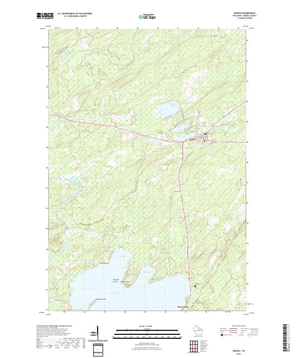
2022 Map of Monico
USGS Topo · Published 2022About this map
Monico serves as the central hub of this northern Wisconsin landscape, where the local road network converges near the Monico Cem. The terrain is defined by an intricate glacial geography of kettle lakes and meandering waterways, including the celestial-named Neptune Lake, Mars Lake, and Venus Lake. To the south, the massive expanse of Pelican Lake dominates the horizon, its shoreline deeply recessed into numerous bays like Mud Bay and Musky Bay.
Find a feature on this map
52 named features on this map. Tap any name to fly to it.
Don’t see what you’re looking for? This feature index may not catch every label — zoom into the map to look around manually.
Map Details
Editions of this 2022 Monico Map
This is the sole edition of this map. No revisions or reprints were ever made.
Other maps of this area

1940 · Parrish
USGS Topo · 1:48,000

1940 · Monico
USGS Topo · 1:48,000

1940 · Rhinelander
USGS Topo · 1:48,000

1942 · Elcho
USGS Topo · 1:48,000

1949 · Rhinelander
USGS Topo · 1:48,000

1950 · Monico
USGS Topo · 1:48,000

1950 · Elcho
USGS Topo · 1:48,000

1950 · Parrish
USGS Topo · 1:48,000

1952 · Parrish
USGS Topo · 1:48,000

1954 · Iron Mountain
USGS Topo · 1:250,000