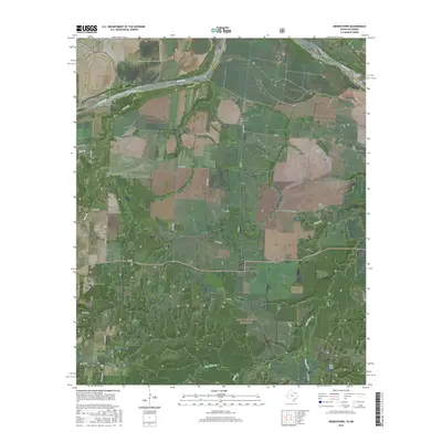
2016 Map of Monkstown
USGS Topo · Published 2016About this map
The Red River forms a wide, meandering boundary along the northern edge of this North Texas landscape, marking the historic divide between Fannin County and Bryan County, Oklahoma. The settlement of Monkstown serves as a local crossroads, while Riverby sits further north near the river banks. Much of the southern portion of the map is defined by the managed acreage of the Caddo National Grassland, where the terrain is carved by numerous small waterways like Bois d'Arc Cr and Tanyard Cr. This area preserves a more natural character compared to the agricultural grid found to the west. Local history is anchored by several small burial sites, including Arch Chapel Cem, Forest Grove Cem, and Bigsby Cem, which suggest the locations of early rural congregations and family homesteads. Small bodies of water like Club Lake and drainage branches such as Mud Br and Black Br further define the local topography.
Find a feature on this map
32 named features on this map. Tap any name to fly to it.
Don’t see what you’re looking for? This feature index may not catch every label — zoom into the map to look around manually.
Map Details
Editions of this 2016 Monkstown Map
This is the sole edition of this map. No revisions or reprints were ever made.
Other maps of this area

1903 · Paris
USGS Topo · 1:125,000

1947 · Honey Grove
USGS Topo · 1:62,500

1948 · Direct
USGS Topo · 1:62,500

1949 · Direct
USGS Topo · 1:62,500

1949 · Honey Grove
USGS Topo · 1:62,500

1953 · Texarkana
USGS Topo · 1:250,000

1954 · Sherman
USGS Topo · 1:250,000

1956 · Texarkana
USGS Topo · 1:250,000

1957 · Wade
USGS Topo · 1:62,500

1958 · Bonham
USGS Topo · 1:62,500