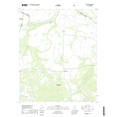
2019 Map of Monkstown
USGS Topo · Published 2019About this map
The Red River defines the northern boundary of this landscape, separating Fannin County, Texas, from Bryan County, Oklahoma. This rural riverfront territory is anchored by the small settlements of Monkstown and Riverby, connected by a network of farm-to-market roads and county routes. The southern portion of the map is dominated by the Caddo National Grassland, a significant public land area where the terrain becomes more varied as it descends toward Bois d'Arc Cr and its tributaries like Sandy Cr and Tanyard Cr. For those tracing local families, several established burial grounds are documented, including Arch Chapel Cem, Forest Grove Cem, and Bigsby Cem. The map illustrates a landscape of managed conservation and agriculture, with numerous small watercourses such as Mud Br and Black Br draining the prairie toward the major river system to the north.
Find a feature on this map
31 named features on this map. Tap any name to fly to it.
Don’t see what you’re looking for? This feature index may not catch every label — zoom into the map to look around manually.
Map Details
Editions of this 2019 Monkstown Map
This is the sole edition of this map. No revisions or reprints were ever made.
Other maps of this area

1903 · Paris
USGS Topo · 1:125,000

1947 · Honey Grove
USGS Topo · 1:62,500

1948 · Direct
USGS Topo · 1:62,500

1949 · Direct
USGS Topo · 1:62,500

1949 · Honey Grove
USGS Topo · 1:62,500

1953 · Texarkana
USGS Topo · 1:250,000

1954 · Sherman
USGS Topo · 1:250,000

1956 · Texarkana
USGS Topo · 1:250,000

1957 · Wade
USGS Topo · 1:62,500

1958 · Bonham
USGS Topo · 1:62,500