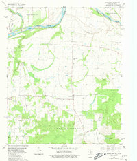
1980 Map of Monkstown
USGS Topo · Published 1981About this map
The Red River meanders across the border of Texas and Oklahoma, defining the northern edge of this agricultural and timber landscape in Fannin County. This 1980s-era survey reveals a transition from the riparian lowlands of the river valley toward the protected wooded terrain of the Caddo National Grassland to the south. Small settlements like Monkstown and Riverby serve as local anchors, while the Riverby Ranch Airfield indicates the integration of aviation into rural land management.
Find a feature on this map
21 named features on this map. Tap any name to fly to it.
Don’t see what you’re looking for? This feature index may not catch every label — zoom into the map to look around manually.
Map Details
Editions of this 1980 Monkstown Map
This is the sole edition of this map. No revisions or reprints were ever made.
Other maps of this area

1903 · Paris
USGS Topo · 1:125,000

1947 · Honey Grove
USGS Topo · 1:62,500

1948 · Direct
USGS Topo · 1:62,500

1949 · Direct
USGS Topo · 1:62,500

1949 · Honey Grove
USGS Topo · 1:62,500

1953 · Texarkana
USGS Topo · 1:250,000

1954 · Sherman
USGS Topo · 1:250,000

1956 · Texarkana
USGS Topo · 1:250,000

1957 · Wade
USGS Topo · 1:62,500

1958 · Bonham
USGS Topo · 1:62,500