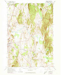
1963 Map of Monkton
USGS Topo · Published 1973About this map
Monkton and Ferrisburg anchor this topographical survey of Addison County, where the Champlain Valley's pastoral lowlands meet the rising ridges of Shellhouse Mountain and Hogback. The landscape is defined by the winding courses of Little Otter Creek and Lewis Creek, which drain a patchwork of dairy farms and rural settlements. A high density of burial grounds, including the Quaker Cem, Old Quaker Cem, and Ridge Cem, offers significant detail for genealogists tracing early families in the region.
Find a feature on this map
45 named features on this map. Tap any name to fly to it.
Don’t see what you’re looking for? This feature index may not catch every label — zoom into the map to look around manually.
Map Details
Editions of this 1963 Monkton Map
3 editions found
Other maps of this area

1894 · Port Henry
USGS Topo · 1:62,500

1895 · Willsboro
USGS Topo · 1:62,500

1898 · Port Henry
USGS Topo · 1:62,500

1903 · Middlebury
USGS Topo · 1:62,500

1905 · Middlebury
USGS Topo · 1:62,500

1906 · Burlington
USGS Topo · 1:62,500

1919 · Burlington
USGS Topo · 1:62,500

1920 · Middlebury
USGS Topo · 1:62,500

1941 · Willsboro
USGS Topo · 1:62,500

1943 · Willsboro
USGS Topo · 1:62,500