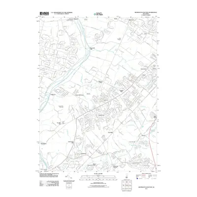
2011 Map of Monmouth Junction
USGS Topo · Published 2011About this map
The Delaware and Raritan Canal carves through the western edge of this landscape, running parallel to the Millstone River near settlements like Griggstown and Blackwells Mills. This 2011 survey captures a suburbanizing region defined by established residential developments such as Kendall Park and Franklin Park, yet preserved open spaces and local history remain prominent. Researchers can find several significant burial grounds, including the Hillsborough Reformed Church at Millstone Cemetery and the Ten Mile Run Cemetery. The transition from industrial corridors to recreation is evident, with the Bunker Hill Golf Course and Franklin Memorial Park occupying large tracts. Further east, the community of Deans sits near the Deans Mills Dam and Davidsons Millpond, while the namesake Monmouth Junction serves as a focal point for the area's transportation network.
Find a feature on this map
67 named features on this map. Tap any name to fly to it.
Don’t see what you’re looking for? This feature index may not catch every label — zoom into the map to look around manually.
Map Details
Editions of this 2011 Monmouth Junction Map
This is the sole edition of this map. No revisions or reprints were ever made.
Other maps of this area

1888 · Plainfield
USGS Topo · 1:62,500

1888 · New Brunswick
USGS Topo · 1:62,500

1888 · Princeton
USGS Topo · 1:62,500

1891 · Somerville
USGS Topo · 1:62,500

1893 · New Brunswick
USGS Topo · 1:62,500

1893 · Plainfield
USGS Topo · 1:62,500

1893 · Somerville
USGS Topo · 1:62,500

1894 · Princeton
USGS Topo · 1:62,500

1898 · Plainfield
USGS Topo · 1:62,500

1898 · Somerville
USGS Topo · 1:62,500
Featured Places
- Franklin Township, NJ
- South Brunswick, NJ
- North Brunswick Township, NJ
- Hillsborough Township, NJ
- Montgomery Township, NJ