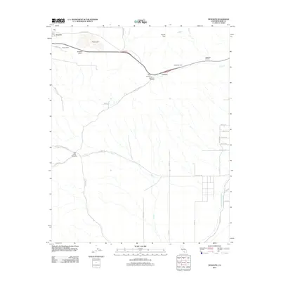
2012 Map of Monolith
USGS Topo · Published 2012About this map
Tehachapi Valley serves as a critical infrastructure corridor in this 2012 survey, where the historic Tehachapi Pass facilitates modern transportation routes alongside vital water systems. The map documents the presence of both the Los Angeles Aqueduct and the Second Los Angeles Aqueduct as they cut through the eastern landscape near Aqueduct Rd. This intersection of industrial water engineering and natural terrain is punctuated by significant relief, including Pajuela Peak and the drainage of Oak Creek Canyon. Settled areas like Monolith and Cameron appear as small hubs within a vast network of service roads and rural routes such as Oak Creek Rd and Jameson Rd. To the north, the seasonal catchment of Proctor Lake and the various tributaries like Cache Cr and La Rose Cr define the hydrological character of the region before it descends toward the desert floor.
Find a feature on this map
38 named features on this map. Tap any name to fly to it.
Don’t see what you’re looking for? This feature index may not catch every label — zoom into the map to look around manually.
Map Details
Editions of this 2012 Monolith Map
This is the sole edition of this map. No revisions or reprints were ever made.
Other maps of this area

1915 · Elizabeth Lake
USGS Topo · 1:125,000

1915 · Mojave
USGS Topo · 1:125,000

1917 · Elizabeth Lake
USGS Topo · 1:125,000

1943 · Rosamond
USGS Topo · 1:62,500

1943 · Tehachapi
USGS Topo · 1:62,500

1943 · Mojave
USGS Topo · 1:62,500

1943 · Willow Springs
USGS Topo · 1:62,500

1947 · Mojave
USGS Topo · 1:24,000

1947 · Soledad Mountain
USGS Topo · 1:24,000

1948 · Bakersfield
USGS Topo · 1:250,000