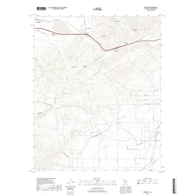
2018 Map of Monolith
USGS Topo · Published 2018About this map
The Tehachapi Pass serves as a critical geographic gateway where the Sierra Nevada meets the Mojave Desert. This 2018 survey documents the complex infrastructure required to move water and people through this high-desert corridor. The Los Angeles Aqueduct and Second Los Angeles Aqueduct are prominent features, snaking through the eastern terrain near Cameron. In the north, the settlement of Monolith sits within the Tehachapi Valley, a hub of industrial activity near the railroad tracks.
Find a feature on this map
45 named features on this map. Tap any name to fly to it.
Don’t see what you’re looking for? This feature index may not catch every label — zoom into the map to look around manually.
Map Details
Editions of this 2018 Monolith Map
This is the sole edition of this map. No revisions or reprints were ever made.
Other maps of this area

1915 · Elizabeth Lake
USGS Topo · 1:125,000

1915 · Mojave
USGS Topo · 1:125,000

1917 · Elizabeth Lake
USGS Topo · 1:125,000

1943 · Rosamond
USGS Topo · 1:62,500

1943 · Tehachapi
USGS Topo · 1:62,500

1943 · Mojave
USGS Topo · 1:62,500

1943 · Willow Springs
USGS Topo · 1:62,500

1947 · Mojave
USGS Topo · 1:24,000

1947 · Soledad Mountain
USGS Topo · 1:24,000

1948 · Bakersfield
USGS Topo · 1:250,000