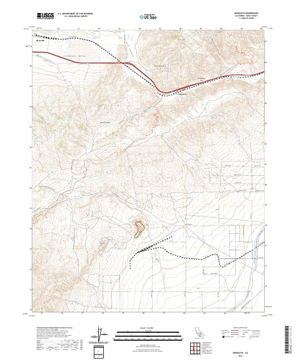
2022 Map of Monolith
USGS Topo · Published 2022About this map
The Tehachapi Valley provides a striking geographic transition on this recent survey, where the southern extent of the Sierra Nevada meets the edge of the Mojave Desert. The settlement of Monolith occupies the northwestern corner of the map, situated along Tehachapi Blvd, while Cameron marks a significant point of passage further east. This area serves as a critical infrastructure corridor, defined by the crossing of the Tehachapi Pass and the engineering of the Los Angeles Aqueduct and the Second Los Angeles Aqueduct, which cut through the southeastern landscape near Aqueduct Rd.
Find a feature on this map
82 named features on this map. Tap any name to fly to it.
Don’t see what you’re looking for? This feature index may not catch every label — zoom into the map to look around manually.
Map Details
Editions of this 2022 Monolith Map
This is the sole edition of this map. No revisions or reprints were ever made.
Other maps of this area

1915 · Elizabeth Lake
USGS Topo · 1:125,000

1915 · Mojave
USGS Topo · 1:125,000

1917 · Elizabeth Lake
USGS Topo · 1:125,000

1943 · Rosamond
USGS Topo · 1:62,500

1943 · Tehachapi
USGS Topo · 1:62,500

1943 · Mojave
USGS Topo · 1:62,500

1943 · Willow Springs
USGS Topo · 1:62,500

1947 · Mojave
USGS Topo · 1:24,000

1947 · Soledad Mountain
USGS Topo · 1:24,000

1948 · Bakersfield
USGS Topo · 1:250,000