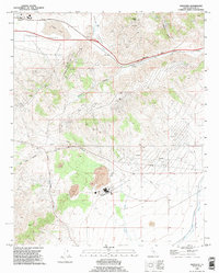
1992 Map of Monolith
USGS Topo · Published 1995About this map
Tehachapi Valley provides a high-altitude backdrop for industrial and transport infrastructure in this 1990s survey. The landscape is defined by the heavy footprint of mineral extraction and utility networks, most notably the numerous Mine and Prospect sites scattered through the foothills. The town of Monolith sits at the edge of the ephemeral Proctor Lake, while the settlement of Cameron marks a strategic point along the Tehachapi Pass. Water management is a primary theme here, captured in the route of the Los Angeles Aqueduct and several Water Tanks. The map also illustrates the modern energy landscape of Kern County, with multiple Generators and Substation facilities appearing alongside traditional natural landmarks like Pajuela Peak and the seasonal flows of Sand Canyon Creek.
Find a feature on this map
38 named features on this map. Tap any name to fly to it.
Don’t see what you’re looking for? This feature index may not catch every label — zoom into the map to look around manually.
Map Details
Editions of this 1992 Monolith Map
This is the sole edition of this map. No revisions or reprints were ever made.
Other maps of this area

1915 · Elizabeth Lake
USGS Topo · 1:125,000

1915 · Mojave
USGS Topo · 1:125,000

1917 · Elizabeth Lake
USGS Topo · 1:125,000

1943 · Rosamond
USGS Topo · 1:62,500

1943 · Tehachapi
USGS Topo · 1:62,500

1943 · Mojave
USGS Topo · 1:62,500

1943 · Willow Springs
USGS Topo · 1:62,500

1947 · Mojave
USGS Topo · 1:24,000

1947 · Soledad Mountain
USGS Topo · 1:24,000

1948 · Bakersfield
USGS Topo · 1:250,000