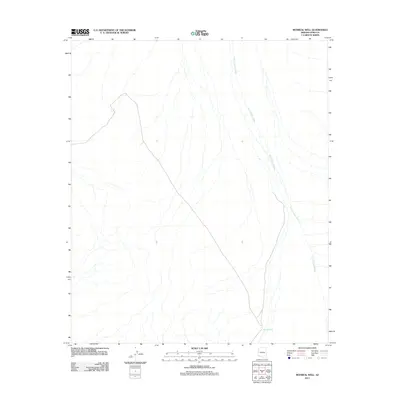
2011 Map of Monreal Well
USGS Topo · Published 2011About this map
Monreal Well serves as a lonely landmark in this arid portion of Yuma County, marking a vital water point in an otherwise sparse desert landscape. The terrain is defined by the sweeping, braided channels of the San Cristobal Wash, which traverses the quadrangle from the northeast toward the south. The 2011 survey reveals a territory with minimal human footprint, characterized by 4WD tracks and local roads that navigate the subtle elevation changes of the desert floor. This map captures the natural drainage patterns and isolated infrastructure necessary for survival and transit in the remote Arizona backcountry before modern development or expanded accessibility altered the character of the region.
Find a feature on this map
2 named features on this map. Tap any name to fly to it.
Don’t see what you’re looking for? This feature index may not catch every label — zoom into the map to look around manually.
Map Details
Editions of this 2011 Monreal Well Map
This is the sole edition of this map. No revisions or reprints were ever made.
Other maps of this area

1927 · Aguila Mountains
USGS Topo · 1:48,000

1927 · Kim
USGS Topo · 1:62,500

1930 · Aguila Mountains
USGS Topo · 1:62,500

1931 · Kim
USGS Topo · 1:62,500

1953 · Ajo
USGS Topo · 1:250,000

1957 · Ajo
USGS Topo · 1:250,000

1958 · Ajo
USGS Topo · 1:250,000

1962 · Ajo
USGS Topo · 1:250,000

1963 · Ajo
USGS Topo · 1:250,000
1965 · Aguila Mountains
USGS Topo · 1:62,500