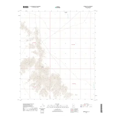
2018 Map of Monreal Well
USGS Topo · Published 2018About this map
Mohawk Mountains rise sharply along the western edge of this arid landscape, defining the rugged topography of the Sonoran Desert in Yuma County. These peaks contrast with the broad drainage of the San Cristobal Valley to the east, where the ephemeral San Cristobal Wash meanders northward. This 2018 survey provides a clear view of the sparse water resources and terrain that shaped travel and habitation in this corner of Arizona, centered on the remote Monreal Well. The map serves as a detailed record of the township and range system, documenting the precise boundaries of t11s r12w, t11s r11w, t12s r12w, and t12s r11w across an environment defined by extreme relief and desert hydrology.
Find a feature on this map
8 named features on this map. Tap any name to fly to it.
Don’t see what you’re looking for? This feature index may not catch every label — zoom into the map to look around manually.
Map Details
Editions of this 2018 Monreal Well Map
This is the sole edition of this map. No revisions or reprints were ever made.
Other maps of this area

1927 · Aguila Mountains
USGS Topo · 1:48,000

1927 · Kim
USGS Topo · 1:62,500

1930 · Aguila Mountains
USGS Topo · 1:62,500

1931 · Kim
USGS Topo · 1:62,500

1953 · Ajo
USGS Topo · 1:250,000

1957 · Ajo
USGS Topo · 1:250,000

1958 · Ajo
USGS Topo · 1:250,000

1962 · Ajo
USGS Topo · 1:250,000

1963 · Ajo
USGS Topo · 1:250,000
1965 · Aguila Mountains
USGS Topo · 1:62,500