
2021 Map of Monreal Well
USGS Topo · Published 2021About this map
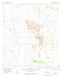
Mohawk Mountains dominate the western portion of this Yuma County landscape, their sharp contours rising abruptly from the surrounding desert floor. This area is defined by the vast drainage system of the San Cristobal Wash, which cuts a broad path through the San Cristobal Valley to the north and east. The map centers on the remote Monreal Well, a critical water point in an otherwise arid expanse. The survey illustrates the stark transition between the steep, complex ridges of the Mohawk range and the wide, flat alluvial plains, providing a precise look at the township and range divisions that overlay this corner of the Sonoran Desert. The isolation of these features reflects the historical challenges of navigation and survival in the southwestern Arizona wilderness.
Find a feature on this map
8 named features on this map. Tap any name to fly to it.
Don’t see what you’re looking for? This feature index may not catch every label — zoom into the map to look around manually.
Map Details
Editions of this 2021 Monreal Well Map
This is the sole edition of this map. No revisions or reprints were ever made.
Other maps of this area

1927 · Aguila Mountains
USGS Topo · 1:48,000

1927 · Kim
USGS Topo · 1:62,500

1930 · Aguila Mountains
USGS Topo · 1:62,500

1931 · Kim
USGS Topo · 1:62,500

1953 · Ajo
USGS Topo · 1:250,000

1957 · Ajo
USGS Topo · 1:250,000

1958 · Ajo
USGS Topo · 1:250,000

1962 · Ajo
USGS Topo · 1:250,000

1963 · Ajo
USGS Topo · 1:250,000
1965 · Aguila Mountains
USGS Topo · 1:62,500