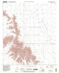
1996 Map of Monreal Well
USGS Topo · Published 2000About this map
The Mohawk Mountains dominate this arid landscape on the border of Yuma County, marking a stark transition into the San Cristobal Valley. Evidence of early prospecting is scattered across the range, with a notable Prospect, Mine Shaft, and several Adits illustrating the area's mineral exploration history. The eastern portion of the map is defined by the broad, sandy channel of the San Cristobal Wash, which drains toward the northwest.
Find a feature on this map
14 named features on this map. Tap any name to fly to it.
Don’t see what you’re looking for? This feature index may not catch every label — zoom into the map to look around manually.
Map Details
Editions of this 1996 Monreal Well Map
This is the sole edition of this map. No revisions or reprints were ever made.
Other maps of this area

1927 · Aguila Mountains
USGS Topo · 1:48,000

1927 · Kim
USGS Topo · 1:62,500

1930 · Aguila Mountains
USGS Topo · 1:62,500

1931 · Kim
USGS Topo · 1:62,500

1953 · Ajo
USGS Topo · 1:250,000

1957 · Ajo
USGS Topo · 1:250,000

1958 · Ajo
USGS Topo · 1:250,000

1962 · Ajo
USGS Topo · 1:250,000

1963 · Ajo
USGS Topo · 1:250,000
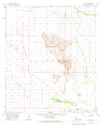
1965 · Aguila Mountains
USGS Topo · 1:62,500