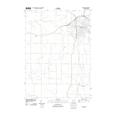
2010 Map of Monroe
USGS Topo · Published 2010About this map
Monroe anchors the northern portion of this landscape, showing the city's residential grid and the Monroe Post Office as it appeared in the early 21st century. The surrounding terrain in Green County is defined by a dense network of agricultural roads and winding waterways, including Honey Creek and Smock Creek, which drain the rolling farmland. Local heritage is preserved in several burial grounds scattered across the countryside, such as Calvary Cemetery, Franklin Cemetery, and Bethel Cemetery.
Find a feature on this map
49 named features on this map. Tap any name to fly to it.
Don’t see what you’re looking for? This feature index may not catch every label — zoom into the map to look around manually.
Map Details
Editions of this 2010 Monroe Map
This is the sole edition of this map. No revisions or reprints were ever made.
Other maps of this area

1920 · Monroe
USGS Topo · 1:62,500

1922 · Monroe
USGS Topo · 1:62,500

1923 · South Wayne
USGS Topo · 1:62,500

1937 · Lena
USGS Topo · 1:48,000

1939 · Freeport
USGS Topo · 1:48,000

1942 · Lena
USGS Topo · 1:62,500

1943 · Lena
USGS Topo · 1:62,500

1944 · Freeport
USGS Topo · 1:62,500

1954 · Rockford
USGS Topo · 1:250,000

1955 · Rockford
USGS Topo · 1:250,000