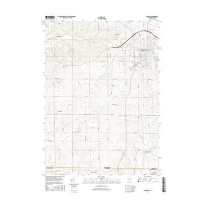
2016 Map of Monroe
USGS Topo · Published 2016About this map
Monroe serves as the primary urban center in this 2016 survey, where a dense grid of streets like 10th St and Aebly Rd meets the open agricultural lands of southern Wisconsin. The landscape is defined by the headwaters of numerous waterways, including Honey Creek and Smock Creek, which carve through the undulating terrain of Green County. Stretching south toward the Wisconsin-Illinois state line, the area transitions into more sparsely settled territory marked by smaller communities such as Clarno and Schneyville. This map is particularly useful for genealogical research, as it identifies several established burial grounds like Franklin Cemetery, Bethel Cemetery, and Greenwood Cemetery, which are scattered among the rural townships. The drainage patterns of Richland Creek and its tributaries further illustrate the natural contours that dictated early settlement and road placement throughout the region.
Find a feature on this map
88 named features on this map. Tap any name to fly to it.
Don’t see what you’re looking for? This feature index may not catch every label — zoom into the map to look around manually.
Map Details
Editions of this 2016 Monroe Map
This is the sole edition of this map. No revisions or reprints were ever made.
Other maps of this area

1920 · Monroe
USGS Topo · 1:62,500

1922 · Monroe
USGS Topo · 1:62,500

1923 · South Wayne
USGS Topo · 1:62,500

1937 · Lena
USGS Topo · 1:48,000

1939 · Freeport
USGS Topo · 1:48,000

1942 · Lena
USGS Topo · 1:62,500

1943 · Lena
USGS Topo · 1:62,500

1944 · Freeport
USGS Topo · 1:62,500

1954 · Rockford
USGS Topo · 1:250,000

1955 · Rockford
USGS Topo · 1:250,000