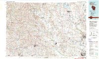
1981 Map of Monroe
USGS Topo · Published 1981About this map
Monroe serves as the focal point of this regional study, which captures the southern Wisconsin dairy country and the Illinois borderlands in the early 1980s. The landscape is defined by the winding course of the Pecatonica River in the west and the Sugar River through the center, feeding into a network of small agricultural hubs like Brodhead and Monticello. The map illustrates the region's cultural heritage in settlements like New Glarus and the recreational value of Yellowstone Lake State Park.
Find a feature on this map
65 named features on this map. Tap any name to fly to it.
Don’t see what you’re looking for? This feature index may not catch every label — zoom into the map to look around manually.
Map Details
Editions of this 1981 Monroe Map
This is the sole edition of this map. No revisions or reprints were ever made.
Other maps of this area

1889 · Evansville
USGS Topo · 1:62,500

1890 · Madison
USGS Topo · 1:62,500

1890 · Sun Prairie
USGS Topo · 1:62,500

1890 · Stoughton
USGS Topo · 1:62,500

1891 · Waterloo
USGS Topo · 1:62,500

1891 · Koshkonong
USGS Topo · 1:62,500

1891 · Janesville
USGS Topo · 1:62,500

1892 · Madison
USGS Topo · 1:62,500

1893 · Janesville
USGS Topo · 1:62,500

1893 · Brodhead
USGS Topo · 1:62,500