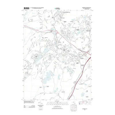
2013 Map of Monroe
USGS Topo · Published 2013About this map
The village of Monroe serves as a central hub in this landscape of southern Orange County, where suburban expansion meets the preserved wilderness of the Hudson Highlands. Residential clusters like Worley Heights and Woodbury Meadows spread between significant water bodies, including the expansive Mombasha Lake and the recreational waters of Walton Lake. Historically significant sites are visible throughout, from the Saint John's Old Cem near Arden to the Bull Mine on the slopes of Bull Mine Mountain, reflecting the area's transition from an early mining and agricultural economy to a residential commuter corridor.
Find a feature on this map
78 named features on this map. Tap any name to fly to it.
Don’t see what you’re looking for? This feature index may not catch every label — zoom into the map to look around manually.
Map Details
Editions of this 2013 Monroe Map
This is the sole edition of this map. No revisions or reprints were ever made.
Other maps of this area

1891 · Greenwood Lake
USGS Topo · 1:62,500

1891 · Ramapo
USGS Topo · 1:62,500

1893 · Greenwood Lake
USGS Topo · 1:62,500

1893 · Ramapo
USGS Topo · 1:62,500

1902 · Schunemunk
USGS Topo · 1:62,500

1903 · Greenwood Lake
USGS Topo · 1:62,500

1906 · Goshen
USGS Topo · 1:62,500

1908 · Goshen
USGS Topo · 1:62,500

1910 · Ramapo
USGS Topo · 1:62,500

1910 · Greenwood Lake
USGS Topo · 1:62,500