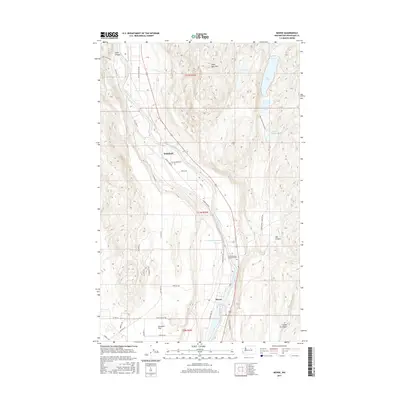
2017 Map of Monse
USGS Topo · Published 2017About this map
The Okanogan River winds through this central Washington landscape, defining the corridor where the small settlements of Monse and Wakefield are established. This 2017 survey details the diverse terrain of Okanogan County, from the high peaks of Soap Lake Mtn to the water bodies of Soap Lake and BJ Lake. Significant cultural sites are marked along the riverbanks, most notably the Fort Okanogan Memorial Cem and the route of Monse Indian Cemetery RD. The map illustrates a region where water management and agriculture meet, shown by the Crazy Rapids Reservoir and the expanse of Brewster Flat. Numerous local roads like Davis Canyon Rd and Old Hwy 97 provide a detailed look at the rural infrastructure connecting these riverfront communities and canyon lands.
Find a feature on this map
36 named features on this map. Tap any name to fly to it.
Don’t see what you’re looking for? This feature index may not catch every label — zoom into the map to look around manually.
Map Details
Editions of this 2017 Monse Map
This is the sole edition of this map. No revisions or reprints were ever made.
Other maps of this area

1905 · Okanogan
USGS Topo · 1:125,000

1954 · Okanogan
USGS Topo · 1:250,000

1956 · Loup Loup
USGS Topo · 1:62,500

1957 · Okanogan
USGS Topo · 1:62,500

1957 · Bridgeport
USGS Topo · 1:62,500

1957 · Brewster
USGS Topo · 1:62,500

1958 · Okanogan
USGS Topo · 1:250,000

1980 · Okanogan
USGS Topo · 1:24,000
1980 · Bridgeport Point
USGS Topo · 1:24,000
1980 · Bridgeport
USGS Topo · 1:24,000