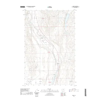
2020 Map of Monse
USGS Topo · Published 2020About this map
The Okanogan River carves a deep valley through this portion of Okanogan County, dictating the placement of settlements and transit routes. The small community of Monse sits along the river's eastern bank, positioned near the Crazy Rapids Reservoir and the Fort Okanogan Memorial Cem. Further north, Wakefield occupies a narrow bench above the water, while the broader plateau of Brewster Flat to the southwest represents the primary agricultural area on this sheet. The terrain transitions sharply from the river bottom to the high ground of Soap Lake Mtn in the north. This upland area is punctuated by a string of small water bodies, including BJ Lake, Soap Lake, and Little Soap Lake. The road network, including Old Hwy 97 and Monse Indian Cemetery Rd, follows the natural contours of the canyons and river bends.
Find a feature on this map
38 named features on this map. Tap any name to fly to it.
Don’t see what you’re looking for? This feature index may not catch every label — zoom into the map to look around manually.
Map Details
Editions of this 2020 Monse Map
This is the sole edition of this map. No revisions or reprints were ever made.
Other maps of this area

1905 · Okanogan
USGS Topo · 1:125,000

1954 · Okanogan
USGS Topo · 1:250,000

1956 · Loup Loup
USGS Topo · 1:62,500

1957 · Okanogan
USGS Topo · 1:62,500

1957 · Bridgeport
USGS Topo · 1:62,500

1957 · Brewster
USGS Topo · 1:62,500

1958 · Okanogan
USGS Topo · 1:250,000

1980 · Okanogan
USGS Topo · 1:24,000
1980 · Bridgeport Point
USGS Topo · 1:24,000
1980 · Bridgeport
USGS Topo · 1:24,000