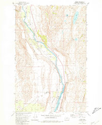
1980 Map of Monse
USGS Topo · Published 1981About this map
Okanogan River waters carve a deep path through north-central Washington, defining the Colville Indian Reservation Boundary as it flows past the small settlement of Monse. This 1980 survey captures a landscape of transition where the Burlington Northern railroad follows the riverbank, connecting isolated points like Wakefield to the broader region. The terrain is marked by the stark contrast between the elevated Soap Lake Mountain and the expansive, level Brewster Flat, which by this era had become home to the Brewster Flat Earth Station. Local history is preserved at the Fort Okanogan Memorial Cem, while the interior remains sparsely developed, characterized by Soap Lake, numerous small springs, and the winding Ophir Grade. Numerous gravel and borrow pits near the river suggest an economy tied to the land and the maintenance of the vital transportation corridor.
Find a feature on this map
28 named features on this map. Tap any name to fly to it.
Don’t see what you’re looking for? This feature index may not catch every label — zoom into the map to look around manually.
Map Details
Editions of this 1980 Monse Map
This is the sole edition of this map. No revisions or reprints were ever made.
Other maps of this area

1905 · Okanogan
USGS Topo · 1:125,000

1954 · Okanogan
USGS Topo · 1:250,000

1956 · Loup Loup
USGS Topo · 1:62,500

1957 · Okanogan
USGS Topo · 1:62,500

1957 · Bridgeport
USGS Topo · 1:62,500

1957 · Brewster
USGS Topo · 1:62,500

1958 · Okanogan
USGS Topo · 1:250,000

1980 · Okanogan
USGS Topo · 1:24,000
1980 · Bridgeport Point
USGS Topo · 1:24,000
1980 · Bridgeport
USGS Topo · 1:24,000