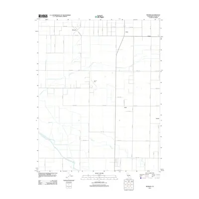
2012 Map of Monson
USGS Topo · Published 2012About this map
Agricultural grids and arterial roadways define this part of Tulare County, where the unincorporated community of Monson sits near the intersection of Road 108 and Avenue 384. The landscape is characterized by a dense network of numbered roads, such as Road 140 and Avenue 388, which facilitate the movement of goods across the Central Valley. To the east, the settlement of Yettem stands as a focal point of local history, while Calgro and Peral mark significant transit points along the north-south corridors. Natural hydrology still influences the layout of the land, with Cottonwood Cr and Elbow Cr winding through the fields before reaching the Saint Johns River at the southern edge of the survey. The presence of Sequoia Field adds a distinct landmark to the central portion of the map, illustrating the mix of civil aviation and rural industry in this region.
Find a feature on this map
36 named features on this map. Tap any name to fly to it.
Don’t see what you’re looking for? This feature index may not catch every label — zoom into the map to look around manually.
Map Details
Editions of this 2012 Monson Map
This is the sole edition of this map. No revisions or reprints were ever made.
Other maps of this area

1921 · Stokes Mountain
USGS Topo · 1:24,000

1922 · Trimmer
USGS Topo · 1:96,000

1923 · Sultana
USGS Topo · 1:31,680

1924 · Reedley
USGS Topo · 1:31,680

1924 · Dinuba
USGS Topo · 1:125,000

1924 · Stokes Mountain
USGS Topo · 1:31,680

1926 · Goshen
USGS Topo · 1:31,680

1926 · Ivanhoe
USGS Topo · 1:31,680

1926 · Exeter
USGS Topo · 1:31,680

1927 · Traver
USGS Topo · 1:31,680