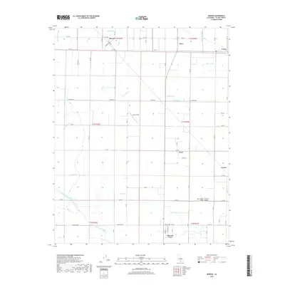
2018 Map of Monson
USGS Topo · Published 2018About this map
Monson, Calgro, and Yettem anchor the agricultural landscape of Tulare County in this 2018 survey. The terrain is defined by a dense network of irrigation and drainage infrastructure, including the Wilson Hunter Ditch, McGee Ditch, and Sontag Ditch, reflecting the intensive water management of the San Joaquin Valley. These engineered waterways crisscross the natural drainage of Cottonwood Cr and Elbow Cr, flowing toward the Saint Johns River in the south. The presence of Sequoia Field and smaller residential pockets like the Patterson Tract and Peral demonstrate the evolution of the rural layout where straight-line road grids, such as Elkhorn Ave and Dairy Ave, overlay the complex hydrological system of the Central Valley.
Find a feature on this map
43 named features on this map. Tap any name to fly to it.
Don’t see what you’re looking for? This feature index may not catch every label — zoom into the map to look around manually.
Map Details
Editions of this 2018 Monson Map
This is the sole edition of this map. No revisions or reprints were ever made.
Other maps of this area

1921 · Stokes Mountain
USGS Topo · 1:24,000

1922 · Trimmer
USGS Topo · 1:96,000

1923 · Sultana
USGS Topo · 1:31,680

1924 · Reedley
USGS Topo · 1:31,680

1924 · Dinuba
USGS Topo · 1:125,000

1924 · Stokes Mountain
USGS Topo · 1:31,680

1926 · Goshen
USGS Topo · 1:31,680

1926 · Ivanhoe
USGS Topo · 1:31,680

1926 · Exeter
USGS Topo · 1:31,680

1927 · Traver
USGS Topo · 1:31,680