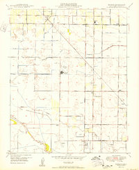
1950 Map of Monson
USGS Topo · Published 1950About this map
Southern Pacific Railroad tracks slice diagonally across this Central Valley landscape, anchoring small agricultural hubs like Monson and Calgro. The area's mid-century water management is clearly visible through an extensive network of irrigation works, including the Hunter Ditch, Cary DITCH, and Elkhorn Ditch. These systems divert water from natural channels like Sand Creek and Cottonwood Creek to support the surrounding orchards and fields.
Find a feature on this map
49 named features on this map. Tap any name to fly to it.
Don’t see what you’re looking for? This feature index may not catch every label — zoom into the map to look around manually.
Map Details
Editions of this 1950 Monson Map
This is the sole edition of this map. No revisions or reprints were ever made.
Other maps of this area

1921 · Stokes Mountain
USGS Topo · 1:24,000

1922 · Trimmer
USGS Topo · 1:96,000

1923 · Sultana
USGS Topo · 1:31,680

1924 · Reedley
USGS Topo · 1:31,680

1924 · Dinuba
USGS Topo · 1:125,000

1924 · Stokes Mountain
USGS Topo · 1:31,680

1926 · Goshen
USGS Topo · 1:31,680

1926 · Ivanhoe
USGS Topo · 1:31,680

1926 · Exeter
USGS Topo · 1:31,680

1927 · Traver
USGS Topo · 1:31,680