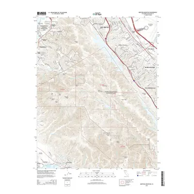
2015 Map of Montara Mountain
USGS Topo · Published 2015About this map
The San Andreas Fault cuts a distinctive path through the heart of the San Francisco Peninsula, defining a landscape of reservoirs and ridges that separate the urbanized bay front from the Pacific coast. High-density residential developments in San Bruno, Millbrae, and Burlingame press right against the protected watersheds of San Andreas Lake and Pilarcitos Lake. The map reveals the intricate infrastructure required to manage this geography, including the Pilarcitos Tunnel and Stone Dam Reservoir. To the west, the topography rises sharply toward the summits of Montara Mountain and Scarpet Peak, part of the sprawling Golden Gate National Recreation Area. Along the coast, established neighborhoods like Pacifica and El Granada flank the massive transit hubs of San Francisco International Airport and Half Moon Bay Airport, illustrating the balance between wilderness preservation and modern suburban expansion.
Find a feature on this map
151 named features on this map. Tap any name to fly to it.
Don’t see what you’re looking for? This feature index may not catch every label — zoom into the map to look around manually.
Map Details
Editions of this 2015 Montara Mountain Map
This is the sole edition of this map. No revisions or reprints were ever made.
Other maps of this area

1892 · San Mateo
USGS Topo · 1:62,500

1896 · San Mateo
USGS Topo · 1:62,500

1899 · San Mateo
USGS Topo · 1:62,500

1902 · Santa Cruz
USGS Topo · 1:125,000

1915 · San Mateo
USGS Topo · 1:62,500

1939 · San Mateo
USGS Topo · 1:62,500

1940 · Halfmoon Bay
USGS Topo · 1:62,500

1943 · San Mateo
USGS Topo · 1:62,500

1943 · Halfmoon Bay
USGS Topo · 1:62,500

1947 · San Francisco
USGS Topo · 1:250,000