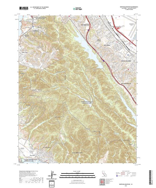
2022 Map of Montara Mountain
USGS Topo · Published 2022About this map
Sweeney Ridge and the Santa Cruz Mountains form a rugged spine across this portion of the San Francisco Peninsula, creating a sharp divide between the coastal communities of Pacifica and the developed bayside corridor. The map reveals the contrast between the dense residential grids of Millbrae and Burlingame near San Francisco International Airport and the preserved wild lands of the Golden Gate National Recreation Area. Significant water management features like San Andreas Lake and Stone Dam Reservoir sit high in the interior ridges, while the western edge is defined by the shifting Pacific coastline from Mori Point south to the protected waters of Half Moon Bay. This survey captures the modern infrastructure of Skyline Blvd and El Camino Real as they navigate the complex topography of the Peninsula.
Find a feature on this map
80 named features on this map. Tap any name to fly to it.
Don’t see what you’re looking for? This feature index may not catch every label — zoom into the map to look around manually.
Map Details
Editions of this 2022 Montara Mountain Map
This is the sole edition of this map. No revisions or reprints were ever made.
Other maps of this area

1892 · San Mateo
USGS Topo · 1:62,500

1896 · San Mateo
USGS Topo · 1:62,500

1899 · San Mateo
USGS Topo · 1:62,500

1902 · Santa Cruz
USGS Topo · 1:125,000

1915 · San Mateo
USGS Topo · 1:62,500

1939 · San Mateo
USGS Topo · 1:62,500

1940 · Halfmoon Bay
USGS Topo · 1:62,500

1943 · San Mateo
USGS Topo · 1:62,500

1943 · Halfmoon Bay
USGS Topo · 1:62,500

1947 · San Francisco
USGS Topo · 1:250,000